What's New :
Target PT - Prelims Classes 2025. Visit Here

Cyclone Tej

Published: 26th Oct, 2023

Context:

The India Meteorological Department (IMD) has predicted the ‘Cyclone Tej,’ a depression gathering force in the Arabian Sea, intensified into an ‘extremely severe cyclonic storm’ near the coasts of Oman and Yemen.

About Cyclone Tej:

  • The cyclonic storm is predicted to move northwestwards and cross the Yemen-Oman coasts between Al Ghaidah (Yemen) and Salalah (Oman) on October 24.
  • This very severe cyclonic storm is predicted to lash with wind speeds around 115-125 kmph.
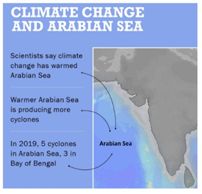

Cyclones in Arabian Sea:

  • The frequency of “very severe cyclonic storms” has increased in recent years over the Arabian Sea.
  • A very severe cyclone is defined as one with wind speeds touching 220 kmph.

Categories of Cyclones:

  • Category 1: Wind speed of 90-125 kph, negligible house damage, some damage to trees and crops.
  • Category 2: Destructive winds of 125-164 kph. Minor house damage, significant damage to trees, crops and caravans, risk of power failure.
  • Category 3: Very destructive winds of 165-224 kph. Some roof and structural damage, some caravans destroyed power failure likely.
  • Category 4: Very destructive winds of 225-279 kph. Significant roofing loss and structural damage, caravans destroyed, blown away, widespread power failures.
  • Category 5: Very destructive winds gusts of more than 280 kph. Extremely dangerous with widespread destruction.
X

Verifying, please be patient.

Enquire Now