
Context
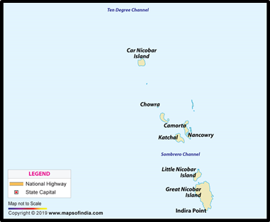
The United States National Aeronautics and Space Administration (NASA) recently highlighted the loss of mangrove cover on Katchal Island, a part of India’s Nicobar archipelago.
About
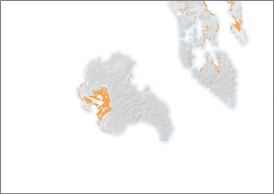
- The NASA Earth Observatory showed a map of the island August 8, 2022, shot from a satellite. It depicted tidal wetland loss from 1999 through 2019 in orange colour.

- The map above shows the real extent of tidal wetlands lost between 1992 and 2019 on Katchal Island in the Nicobar Islands in the eastern Indian Ocean.
- After the magnitude-9.2 Aceh-Andaman earthquake in December 2004, the islands experienced up to 3 meters (10 feet) of land subsidence.
- This submerged many mangrove ecosystems, resulting in a loss of more than 90 percent of mangrove extent in some areas.
Key Findings:
Tidal wetlands
- High-resolution mapping of losses and gains of Earth’s tidal wetlands found that 4,000 square kilometres of tidal wetlands were lost between 1999 and 2019.
- Mangroves had the highest ratio of loss to gain among the three types of tidal wetlands it studied. The other two were tidal flats and marshes.
- Some 27 per cent of the losses and gains were directly caused by human activity.
- Humans can alter wetlands through development, water diversion projects, or by converting the land to agriculture or aquaculture.
- Other causes of wetland change were sea level rise, shoreline erosion, storms, altered sediment flow and subsidence.
- These can be either indirectly caused by humans or the result of natural coastal processes.
Katchal Island
- The Island of Katchal, was earlier referred to as ‘Tihnyu’ in the local language.
- Katchal is home to both indigenous and non-indigenous people and comprises of the Nicobarese Tribes, which are the original inhabitants along with migrated Tamilians, who joined towards the end of the British rule.
- A special permission is required to visit to the Island and is not open to tourists or outsiders without the permission and supervision of the local administration.
- The Katchal Island is the largest Island among all the other Nicobar Islands and was comprised of 35 villages prior to the Tsunami.
- The highest peak within the Island of Katchal is around 835 feet high.
- There are about 5 different languages spoken within this Island, including Tamil, Telugu, Nicobari, Hindi and Santhali.
- The Government of India has declared the Nicobar Islands to be an Aboriginal Tribal Reserve Area, to protect the tribes and natives from any kind of outside exploitation or over modernization of the zone, restricting even tourists without permission.
- The small and large hills of the Katchal Island are made of Calcareous Sandstone and marble slates and in the beautiful tropical forest of Katchal one will find lots of Pythons, Black Monkeys and Pigs.
- The main source of earning and the base of their economy used to lie only in the trade of Coconut, Betelnut or Arecanut product and bi-products, especially for the natives and village dwellers.


