
Published: 29th Sep, 2018
- NASA has launched ICEsat-2 (Ice, Cloud and land Elevation) mission to track ice loss and improve forecasts of sea level rise around the world.
- The launch marks the first attempt in nearly a decade of NASA putting a tool in orbit to measure ice sheet surface elevation across the globe. The preceding mission, ICESat, was launched in 2003 and ended in 2009.
Context
- NASA has launched ICEsat-2 (Ice, Cloud and land Elevation) mission to track ice loss and improve forecasts of sea level rise around the world.
- The launch marks the first attempt in nearly a decade of NASA putting a tool in orbit to measure ice sheet surface elevation across the globe. The preceding mission, ICESat, was launched in 2003 and ended in 2009.
About
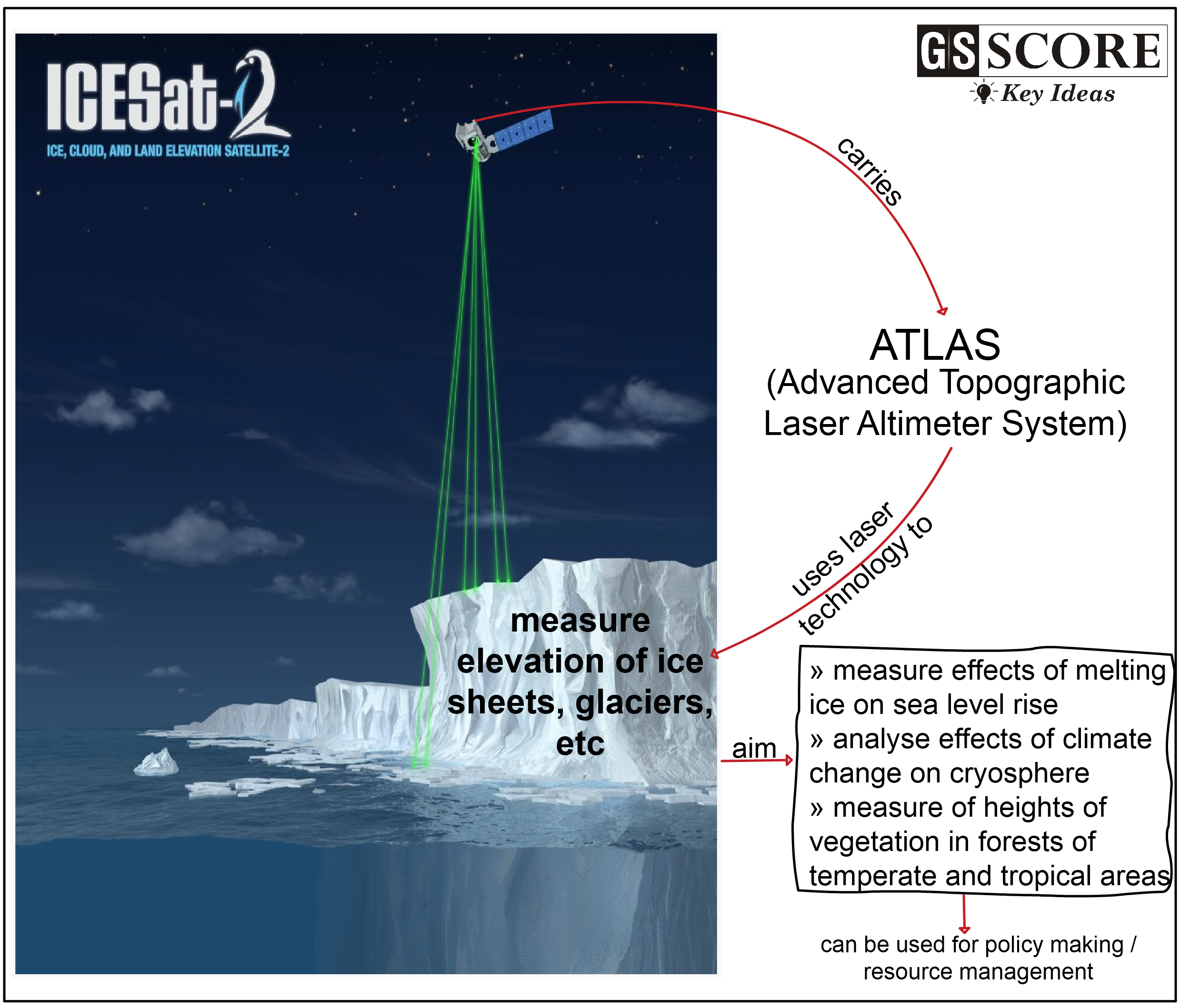
- Mission:
a. The Ice, Cloud, and Land Elevation Satellite-2, or ICESat-2, will measure the height of changing Earth, one laser pulse at a time, 10,000 laser pulses a second.
b. ICESat-2 carry a photon-counting laser altimeter, Advanced Topographic Laser Altimeter System (ATLAS) that will allow scientists to measure the elevation of ice sheets, glaciers, sea ice and more - all in unprecedented detail. - How will it help scientists?
a. Measure melting ice sheets and investigate how this effects sea level rise,
b. Measure and investigate changes in the mass of ice sheets and glaciers,
c. Estimate and study sea ice thickness,
d. Measure the height of vegetation in forests of tropical and temperate regions worldwide.
e. Investigate why, and how much, our cryosphere is changing in a warming climate. - Applications of the ICEsat-2:
a. It is to engage people -- ice scientists, ecologists, hydrologists, the Navy, and others who will use these height observations to provide fundamental knowledge of how ICESat-2 data products can be used in resource management, policy development and decision making. - Improvement over ICEsat-1:
a. The ICESat-2 is the 2nd-generation laser altimeter ICESat mission, carrying a photon-counting laser altimeter (ATLAS) that will allow scientists with findings over and above from ICEsat-1
Significance
- ICESat-2 will help in detection of accelerated melting of ice and snow and can provide an early warning many years before ice breakup could be detected from increased numbers of icebergs in the ocean.
- It is also designed to observe seasonal and inter-annual variations in surface elevation that are caused by variations in precipitation (snowfall) and surface melting.
Learning Aid