

9th April 2025 (9 Topics)
1
Apr
2
Apr
3
Apr
4
Apr
5
Apr
7
Apr
8
Apr
9
Apr
10
Apr
11
Apr
12
Apr
14
Apr
15
Apr
16
Apr
17
Apr
18
Apr
19
Apr
21
Apr
22
Apr
23
Apr
24
Apr
25
Apr
26
Apr
28
Apr
29
Apr
30
Apr
Monsoon Forecast 2025
Context
Private weather agency Skymet has released its first official forecast for the 2025 southwest monsoon, predicting ‘normal’ rainfall at 103% of the Long Period Average (LPA).
What is Monsoon?
- The term monsoon refers to a seasonal reversal of winds, typically associated with heavy rainfall.
- In India, the Southwest Monsoon (June–September) is the main rainy season, contributing 80–90% of the country’s annual rainfall.
- Onset & Progress of Monsoon
- The monsoon starts in Kerala around June 1st.
- It then advances northwards, reaching Mumbai in ~10 days, Delhi by end of June, and entire India by mid-July.
- The retreating monsoon (also called Northeast Monsoon) starts withdrawing from Rajasthan around September, fully withdrawing by mid-October.
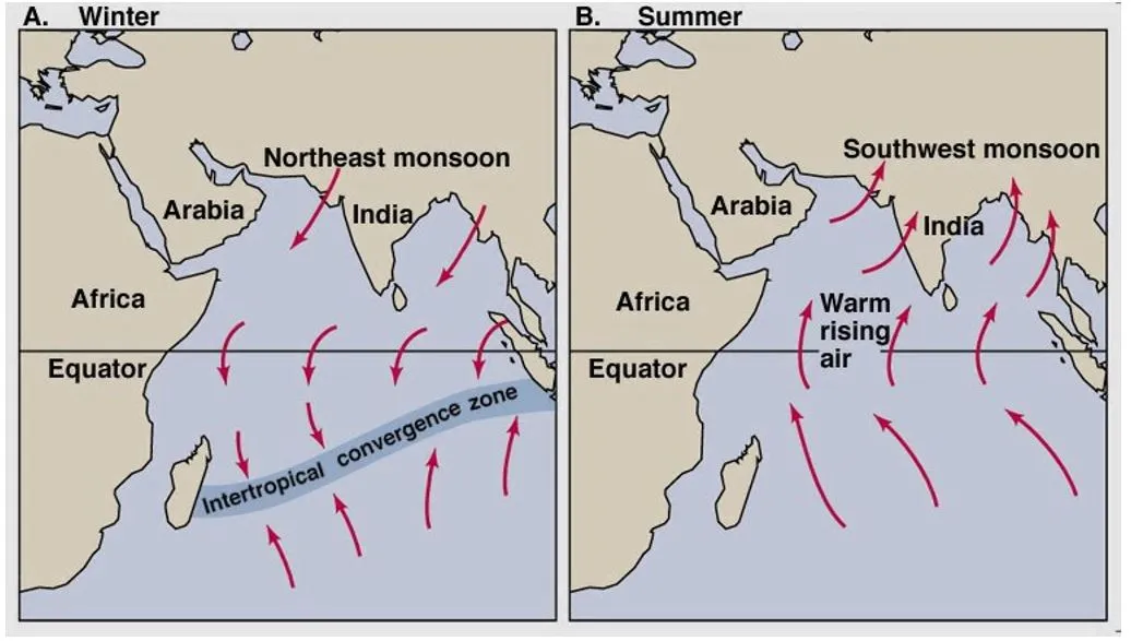
Why Does the Monsoon Occur?
- Differential Heating of Land and Sea: During summer, the land (especially North India) heats up faster than the sea. This creates a low-pressure zone over land and high pressure over the Indian Ocean. Moisture-laden winds from the ocean move toward the land to fill this void.
- Inter-Tropical Convergence Zone (ITCZ): The ITCZ is a belt of low pressure near the equator where trade winds converge. In Indian summer, the ITCZ shifts northward (near the Tropic of Cancer) because the northern hemisphere is tilted toward the Sun. This pulls monsoon winds deep into the Indian subcontinent.
- Coriolis Force: Due to Earth’s rotation, the winds deflect to the right in the northern hemisphere. This turns the southeast trade winds into southwest monsoon winds over India.
- Other Climatic Factors Affecting Monsoon
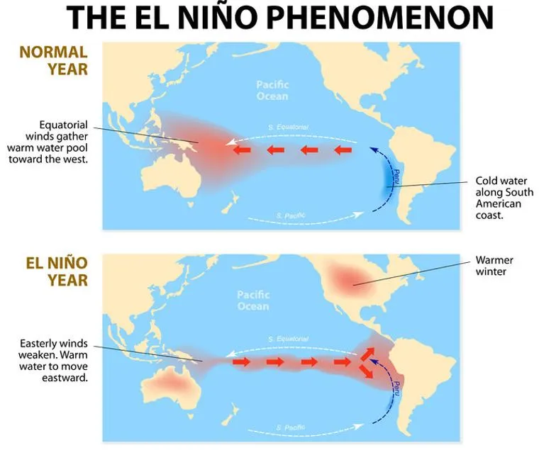
- El Niño: Warming in central/east Pacific Ocean ? Weakens Indian monsoon (can cause droughts)
- La Niña: Cooling in the Pacific ? Strengthens monsoon
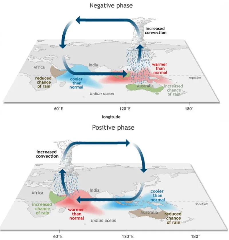
- Indian Ocean Dipole (IOD): Positive IOD (warmer west Indian Ocean) ? Enhances monsoon
- Equatorial Indian Ocean Oscillation: Affects monsoon build-up and variability
- Western Disturbances: Interact with monsoon and winter weather over North India
Branches of Southwest Monsoon |
||
|
Branch |
Path |
Impact |
|
Arabian Sea Branch |
Hits Western Ghats |
Heavy rainfall in Kerala, Karnataka, Maharashtra, Goa |
|
Bay of Bengal Branch |
Moves toward Northeast and Indo-Gangetic Plains |
Rain in Assam, West Bengal, Bihar, UP |
Fact Box:Key-Concepts
|
More Articles