

27th July 2022 (8 Topics)
1
Jul
2
Jul
4
Jul
5
Jul
6
Jul
7
Jul
8
Jul
9
Jul
11
Jul
12
Jul
13
Jul
14
Jul
15
Jul
16
Jul
18
Jul
19
Jul
20
Jul
21
Jul
22
Jul
23
Jul
25
Jul
26
Jul
27
Jul
28
Jul
29
Jul
30
Jul
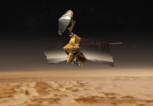
NASA releases first pieces of the multispectral maps of Mars
Context
According to National Aeronautics and Space Administration (NASA), scientists released the first pieces of the multispectral maps made by the Compact Reconnaissance Imaging Spectrometer for Mars (CRISM).
About
What is CRISM?
- The Compact Reconnaissance Imaging Spectrometer for Mars is known as CRISM.
- CRISM uses detectors that see in visible, infrared and near-infrared wavelengths to map the kind of mineral residue that appears where water once existed.
- It searches for the residue of minerals that form in the presence of water, perhaps in association with ancient hot springs, thermal vents, lakes, or ponds that may have existed on the surface of Mars.
CRISM's science goals are:
- Using the spectral fingerprints of minerals that form in liquid water, find where Mars had persistently wet environments.
- By mapping the composition and layering of rock formations, understand what processes formed and altered the Martian crust.
- By measuring the changing amounts of dust, ice, water vapor and other gases in the atmosphere, help to understand Mars' modern climate.
Target Achieved:
- The coverage goal for the multispectral mode was 80 per cent, owing to the limited lifetime of the coolers needed by its infrared detector. But it has managed to exceed that goal.
- It has managed to map 86 per cent of Mars’ surface with its multispectral mode, detecting nearly all of the minerals on the surface.
- The hyper spectral mode, which uses the wavelengths from the visible and near-infrared (VNIR) detector, doesn’t require cryogenic cooling and has attained more than 99 per cent coverage.