
22nd February 2025 (11 Topics)
1
Feb
3
Feb
4
Feb
5
Feb
6
Feb
7
Feb
8
Feb
10
Feb
11
Feb
12
Feb
13
Feb
14
Feb
15
Feb
17
Feb
18
Feb
19
Feb
20
Feb
21
Feb
22
Feb
24
Feb
25
Feb
26
Feb
27
Feb
28
Feb
North Iraq Sinking?
Context
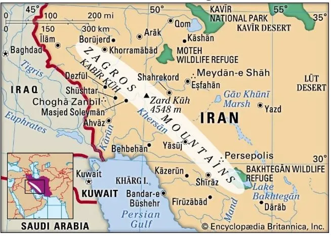
The northern region of Iraq, especially around the Zagros Mountains, is slowly sinking into the Earth. This process is happening very slowly, over millions of years, and is caused by forces deep inside the Earth. This is not something that can be seen happening quickly like a sinkhole; it's a very gradual change.
Key-findings of the Study
- Neotethys Oceanic Plate Rupture: The study reveals that the Neotethys oceanic plate (once the seafloor between the Arabian and Eurasian continents) is slowly breaking off horizontally. This rupture is extending from southeast Turkey to northwest Iran.
- The sinking of this oceanic plate (part of plate tectonics) beneath the Earth's surface contributes significantly to the bending and subsiding of the region’s surface.
- Surface Depression and Sediment Accumulation:
- Over millions of years, the immense weight of the Zagros Mountains has caused the Earth's surface around the mountains to bend downward. Sediments eroded from the mountains accumulated in the depression, forming plains like Mesopotamia in the Middle East.
- Depression of 3-4 km deep is observed, which could not be solely explained by the weight of the mountains. Instead, the sinking oceanic plate beneath the region is playing a key role in pulling the surface downward, making space for more sediment to accumulate.
Why is it Sinking?
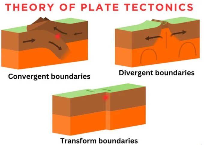
- The sinking is caused by a tectonic process. The Earth’s surface is made up of large plates, and these plates are constantly moving.
- Tectonic Plates: The plates that make up the Earth's surface are constantly moving, and where they meet, they can cause changes to the land above.
- Neotethys Slab: Below the Zagros Mountains, there is a piece of ocean floor called the Neotethys slab. This slab is slowly sinking into the Earth’s mantle (the layer below the crust). This process started millions of years ago when the oceanic plate broke off, and it's still happening today.
- Plate Collision: The sinking is happening because the Arabian Plate and the Eurasian Plate are colliding. This collision has created the Zagros Mountains, and the sinking slab is pulling the land down with it.
Fact Box:Key Concepts:
Key-location Zagros Mountains (Kurdistan Region, Iraq):
Mesopotamia (Middle East):
|